153
153
Dec 5, 2012
12/12
by
KRON
tv
eye 153
favorite 0
quote 0
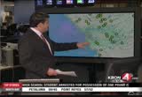
we're also watching the napa river and this did not cost too much flooding. we're keeping our eyes on the crude level is around 5 ft.. flood level is not until it reaches 13. if >> mike pelton is liven berkeley. >> there is a pretty good downpour and you can see the rain falling on your screen. it has been doing this all morning long. normally i met the berkeley, reyna and you can see san francisco from across the way. it is not so today because it is pitch black. the storm is moving through the bay area and there is not a lot away in the but the water is come and it is just a lot rain that we are same. there is no exaggeration that some of the heaviest forces have been not as bad as what we saw over the weekend. if you are hoping for a nicer day today at least in berkeley is not the case. >> the wins will pick up later on this afternoon and they will be about 10 to 20 mi. per hour. by the time that afternoon will roll around most of the bay area will start to dry out. we are looking as storm tracker 4 that is showing all of the yellow. there's some orange he
we're also watching the napa river and this did not cost too much flooding. we're keeping our eyes on the crude level is around 5 ft.. flood level is not until it reaches 13. if >> mike pelton is liven berkeley. >> there is a pretty good downpour and you can see the rain falling on your screen. it has been doing this all morning long. normally i met the berkeley, reyna and you can see san francisco from across the way. it is not so today because it is pitch black. the storm is...
260
260
tv
eye 260
favorite 0
quote 1
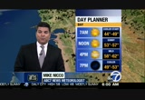
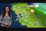
let's take about what waits for you. 37 santa rosa, 40 napa, a lot of 40s around our neighborhoods until you get to mountain view and san jose, 50 in mountain view and 51 san jose. the bay starting off with sunshine, mid to upper 40s. by noon mid to upper 50s. you can see mild this afternoon, close to average upper 50s to low 60s, heavier coat by 7:00, temperatures in the upper 40s to mid 50s for your evening nest fifths. -- evening festivities. upper 50s at the coast, fog stubborn inland visibilities down quarter mile or less in some areas that is going to hold temperatures back, afternoon sun upper 50s to low 60s. >>> so far friday light smooth sailing northbound 87 san jose traffic at the limit no problems past hp pavilion northbound. bunching up a little where 580 merges with 80, slow traffic in the westbound direction, a lot of headlights towards the macarthur maze and berkeley curve into the bay bridge toll, expecting m l any time it is moving, not -- expecting metering lights a time but it is moving. a look at our traffic app n is the waze app, mike has been talking about fog, our
let's take about what waits for you. 37 santa rosa, 40 napa, a lot of 40s around our neighborhoods until you get to mountain view and san jose, 50 in mountain view and 51 san jose. the bay starting off with sunshine, mid to upper 40s. by noon mid to upper 50s. you can see mild this afternoon, close to average upper 50s to low 60s, heavier coat by 7:00, temperatures in the upper 40s to mid 50s for your evening nest fifths. -- evening festivities. upper 50s at the coast, fog stubborn inland...
113
113
Dec 8, 2012
12/12
by
KOFY
tv
eye 113
favorite 0
quote 0
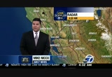
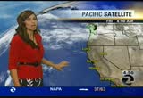
santa rosa and napa. we have upper 40's to lo's right around the bay. chilly overnight period. move on to the forecast feature chilly overnight with patchy valley fog cold in a few spots. sunny weekend with milder weather on sunday and cooler by midweek next week check out the low down to 35 santa rosa 36 napa 37 at fairfield not too wide spread and location is closer to the bay and coast. see low in the mid 40's overnight tonight. on we go to the satellite radar composite image that show as very large ridge of high pressure taking control of the weather picture next several days. this will give us milder weather through the weaned and into early next wee week. move along with our forecast animation 11:00 o'clock tonight. fog will chicken and spread through the central valley then spill in through the delta carquinez strait into pockets in our interior valley and east bay north bay so that's why we see some patchy fog over night. but again not wide sprae. tomorrow afternoon mainly sunny skies. a little milder. high pressure in the south bay. in the low 60's up to 62 at santa cl
santa rosa and napa. we have upper 40's to lo's right around the bay. chilly overnight period. move on to the forecast feature chilly overnight with patchy valley fog cold in a few spots. sunny weekend with milder weather on sunday and cooler by midweek next week check out the low down to 35 santa rosa 36 napa 37 at fairfield not too wide spread and location is closer to the bay and coast. see low in the mid 40's overnight tonight. on we go to the satellite radar composite image that show as...
113
113
tv
eye 113
favorite 0
quote 0
at the reporting stations thickest napa and novato. in my drive it was quarter to an 8th of a mile on 680 and 24 in spots not near the reporting stations. the fog is going to lift upper 50s to low 60s inland. coast light breeze and upper 50s today. >>> no fog in marin coming in this morning up and over the waldo clear. one lane both directions north end of the golden gate span due to roadwork picked up 5:30 roadwork throughout marin north and southbound 101 between strawberry and sausalito in the northbound direction. southbound you get the cones up and over the waldo for that golden gate bridge approach. north 101 university accident blocking on-ramp car in a ditch with tow truck on scene. eastbound 80 at central that off-ramp blocked by a box truck that got into an accident there. >>> 4:33. a story only on abc 7. dozens in the south bay are wondering where their cars are this morning. the consignment service they were using to sell their vehicles has packed up and moved on, without warning. amy hollyfield is in sunnyvale with more. >
at the reporting stations thickest napa and novato. in my drive it was quarter to an 8th of a mile on 680 and 24 in spots not near the reporting stations. the fog is going to lift upper 50s to low 60s inland. coast light breeze and upper 50s today. >>> no fog in marin coming in this morning up and over the waldo clear. one lane both directions north end of the golden gate span due to roadwork picked up 5:30 roadwork throughout marin north and southbound 101 between strawberry and...
114
114
tv
eye 114
favorite 0
quote 0
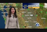
napa is down to the mid 40's along with concord river more it's on the cold side. san rafael 46 degrees. where do we stand with rain. san francisco 167 percent of average. 179 in santa rosa. oakland well above where you should be at 162 of afternoon and even san jose of lag behind not the case. it's at 135 percent normal. sacramento and ukiah way above as well. but the rain is gone. put the umbrella away and enjoying sun sets like this this was posted by david p to my face book page. south san francisco stunning view of the sunset tonight. like i said you will be seeing more of those over the weekend to areas of fog overnight. dense in spots tomorrow morning so that could be problematic. mild and dry forth upcoming weekend. even head nag early next week. satellite radar this is the area of high pressure that is now diverting the jet stream and the stormtrack way up to the north so high pressure is expanding as it carts calling the shots. nice dry pattern and sunshine with us so overnight tonight the fog already starting to spill over into the north and east bay val
napa is down to the mid 40's along with concord river more it's on the cold side. san rafael 46 degrees. where do we stand with rain. san francisco 167 percent of average. 179 in santa rosa. oakland well above where you should be at 162 of afternoon and even san jose of lag behind not the case. it's at 135 percent normal. sacramento and ukiah way above as well. but the rain is gone. put the umbrella away and enjoying sun sets like this this was posted by david p to my face book page. south san...
178
178
Dec 7, 2012
12/12
by
KOFY
tv
eye 178
favorite 0
quote 1
napa is down to the mid 40's along with concord river more it's on the cold side. san rafael 46 degrees. where do we stand with rain. san francisco 167 percent of average. 179 in santa rosa. oakland well above where you should be at 162 of afternoon and even san jose of lag behind not the case. it's at 135 percent normal. sacramento and ukiah way above as well. but the rain is gone. put the umbrella away and enjoying sun sets like this this was posted by david p to my face book page. south san francisco stunning view of the sunset tonight. like i said you will be seeing more of those over the weekend to areas of fog overnight. dense in spots tomorrow morning so that could be problematic. mild and dry forth upcoming weekend. even head nag early next week. satellite radar this is the area of high pressure that is now diverting the jet stream and the stormtrack way up to the north so high pressure is expanding as it carts calling the shots. nice dry pattern and sunshine with us so overnight tonight the fog already starting to spill over into the north and east bay val
napa is down to the mid 40's along with concord river more it's on the cold side. san rafael 46 degrees. where do we stand with rain. san francisco 167 percent of average. 179 in santa rosa. oakland well above where you should be at 162 of afternoon and even san jose of lag behind not the case. it's at 135 percent normal. sacramento and ukiah way above as well. but the rain is gone. put the umbrella away and enjoying sun sets like this this was posted by david p to my face book page. south san...
330
330
tv
eye 330
favorite 0
quote 0
napa is down to the mid 40's along with concord river more it's on the cold side. san rafael 46 degrees. where do we stand with rain. san francisco 167 percent of average. 179 in santa rosa. oakland well above where you should be at 162 of afternoon and even san jose of lag behind not the case. it's at 135 percent normal. sacramento and ukiah way above as well. but the rain is gone. put the umbrella away and enjoying sun sets like this this was posted by david p to my face book page. south san francisco stunning view of the sunset tonight. like i said you will be seeing more of those over the weekend to areas of fog overnight. dense in spots tomorrow morning so that could be problematic. mild and dry forth upcoming weekend. even head nag early next week. satellite radar this is the area of high pressure that is now diverting the jet stream and the stormtrack way up to the north so high pressure is expanding as it carts calling the shots. nice dry pattern and sunshine with us so overnight tonight the fog already starting to spill over into the north and east bay val
napa is down to the mid 40's along with concord river more it's on the cold side. san rafael 46 degrees. where do we stand with rain. san francisco 167 percent of average. 179 in santa rosa. oakland well above where you should be at 162 of afternoon and even san jose of lag behind not the case. it's at 135 percent normal. sacramento and ukiah way above as well. but the rain is gone. put the umbrella away and enjoying sun sets like this this was posted by david p to my face book page. south san...
121
121
Dec 7, 2012
12/12
by
KTVU
tv
eye 121
favorite 0
quote 0
we have patchy dense fog reported in areas like napa, novato. take it easy in and along the east bay we are pretty good. a little bit of fog reported around concord. visibility about six miles. as we get into the afternoon mostly sunny skies, mild weather in store for the second half of your day with light winds. into the weekend we'll continue with the patchy fog through the morning hours. by sunday we could be looking at breezy conditions but we'll be tracking that for you between now and then. upper 30s to low 40s in and around our inland locations. 37 in santa rosa. 39 for napa. low 40s in fairfield. 40s to near 50-degrees around the bay. we'll continue to cool as we head into sunrise just after 7:00. afternoon highs for today not too bad. 62 in novato. 61 for san francisco. low 60s for the east bay. 63 san jose as well as morgan hill. there is your extended forecast. fairly nice weekend in store. mostly clear skies in the afternoon. low to mid 60s in the forecast for the second half of your day. >>> coming up next in our 5:00 hour locked ou
we have patchy dense fog reported in areas like napa, novato. take it easy in and along the east bay we are pretty good. a little bit of fog reported around concord. visibility about six miles. as we get into the afternoon mostly sunny skies, mild weather in store for the second half of your day with light winds. into the weekend we'll continue with the patchy fog through the morning hours. by sunday we could be looking at breezy conditions but we'll be tracking that for you between now and...
537
537
tv
eye 537
favorite 0
quote 0
since then the napa river, napa creek protection project have made significant improvements to prevent that from happening again. but city officials say they are confident they can deal with the expected water flow. i went to downtown napa and not a lot of businesses open this early in the morning. at the coffee roasting company they had a theory. they were loit hearted and they tell us they live by the ed henderson rule. hoe says unless it rains for four days in a row, then it will flood. if it doesn't, it won't flood. there have been so many breaks in the storm they feel confident their city will be safe. reporting live in downtown napa, cara clapper, abc news. >> thank you, cara. >>> flood warnings are in affect for the russian river. early tomorrow morning the river is already running high and the ground is saturated. it is forecast to reach flood stage at 32 feet around 2:00 tomorrow morning. it is expected to crest at 35 feet around noon. the petaluma river may also reach flood stage within just a few hours. this video from friday shows an industrial avenue parking lot that is al
since then the napa river, napa creek protection project have made significant improvements to prevent that from happening again. but city officials say they are confident they can deal with the expected water flow. i went to downtown napa and not a lot of businesses open this early in the morning. at the coffee roasting company they had a theory. they were loit hearted and they tell us they live by the ed henderson rule. hoe says unless it rains for four days in a row, then it will flood. if...
212
212
Dec 7, 2012
12/12
by
KTVU
tv
eye 212
favorite 0
quote 1
patchy and dense fog in napa, novato, livermore. giving you a live look at some sunshine bouncing off that building what. a gorgeous start to the -- what a gore says start to the day -- gorgeous start to the day. we'll see the fog through the next hour or so. getting through the 8:00 hour still gonna be quite chilly. by about 10:00 or so, feeling better, low to mid-50 and then your lunch hour. 62 in hayward. 61 in san francisco. low 60s redwood city, san jose into morgan hill. the extended forecast. the temperatures will warm average by several degrees. afternoon highs mid- to upper 60s back to you. >>> just as some employees get whack to -- get back to work. the new group of workers who say they could be hitting picket lanes during one of the busiest seasons for the port of oakland. >>> swee have new information about a man who took a dangerous fall here in oakland. that's coming up. >>> and could same-sex marriage be once again legal in -- legal in california? ñ? good morning! wow. want to start the day with something heart healt
patchy and dense fog in napa, novato, livermore. giving you a live look at some sunshine bouncing off that building what. a gorgeous start to the -- what a gore says start to the day -- gorgeous start to the day. we'll see the fog through the next hour or so. getting through the 8:00 hour still gonna be quite chilly. by about 10:00 or so, feeling better, low to mid-50 and then your lunch hour. 62 in hayward. 61 in san francisco. low 60s redwood city, san jose into morgan hill. the extended...
296
296
tv
eye 296
favorite 0
quote 1
the wind is whipping through napa. we have a look at the river this morning whereas carolyn mentioned, flooding is a concern. it was expected that the river would surpass it's flood level about noon today. now that's changed. estimates go anywhere from 1:00 p.m. to between 5:00 p.m. and 6:00 p.m. estimates are the water could rise and reach 25 to 27 feet. elsewhere here in napa you can see downtown. it is just soaked. the whole city is soaking wet. wind again a big factor this morning. not a lot of cars on the road. i popped into the one business open. that's starbucks on the corner. they say they are a lot emptier than they usually are this time of morning. normally people are out but people are staying inside and that's probably a good thing as the wind and rain creates very dangerous conditions for driving, as carolyn pointed out with breaking news this morning. for now that's the latest from downtown napa. abc7 news. >>> flood warnings are in effect for the russian river. it is predicted to reach flood stage at gur
the wind is whipping through napa. we have a look at the river this morning whereas carolyn mentioned, flooding is a concern. it was expected that the river would surpass it's flood level about noon today. now that's changed. estimates go anywhere from 1:00 p.m. to between 5:00 p.m. and 6:00 p.m. estimates are the water could rise and reach 25 to 27 feet. elsewhere here in napa you can see downtown. it is just soaked. the whole city is soaking wet. wind again a big factor this morning. not a...
237
237
Dec 4, 2012
12/12
by
KOFY
tv
eye 237
favorite 0
quote 1
when napa creek overflowed its banks. this time it didn't. thanks mostly to 35 million dollar federally funded bipass project by the army corps of engineers. >> design worked as intended. >>reporter: project simple and condition september more difficult next cushion. really a matter of rechanneling water. below my feet this culvert has doubled x's ty. if it weren't here last weekend the area probably would have flooded. >> it can be dramatic. very fast. and it can create significant damage. >>reporter: napa has suffered through 24 serious floods since the civil war. last weekend could easily have been the 25t 25th. outsiders think first of the napa river that floods once every seven years but the creek overruns the banks three times as often. >> our old pair dime was that 4 inches of rain in 6 hours up on western water shed of the napa area would cause a flood on this creek. we are certain now that the capacity of such that number doesn't hold any longer. >>reporter: 12 inches fellas weekend but where bottle neck portion of the creek used to
when napa creek overflowed its banks. this time it didn't. thanks mostly to 35 million dollar federally funded bipass project by the army corps of engineers. >> design worked as intended. >>reporter: project simple and condition september more difficult next cushion. really a matter of rechanneling water. below my feet this culvert has doubled x's ty. if it weren't here last weekend the area probably would have flooded. >> it can be dramatic. very fast. and it can create...
236
236
tv
eye 236
favorite 0
quote 0
. >> ama: in napa, the national weather service issued a flood warning for the napa river, a waterway prone to flooding, and the city's residents are hoping it's not a repeat of the devastating flood in 2005. >> the napa river looks calm now but that could change in a hurry tonight with another round of heavy rains about to hit. serious floods are common here, and residents are on alert, preparing by filling sandbags provided by the city. >> when stuff like this happens, city of napa takes care of napa. >> residents filled 700 bags, ten tons of sand in three hours this morning. >> my son and i picked up 12 sandbags. >> he had the forsythe to plan ahead because of the past. his home has flooded three times. sanbags are one of many weapons in his arsenal. >> we expect the worst to be tomorrow morning. that usually happenings. the rain falls, river rises, comes down and floods our area. >> the national weather service warns the river will rise above flood stage tomorrow in 2005, the river overwhelmed downtown napa and flooded thousands of acres. 1,000 homes were flooded or destroyed. sin
. >> ama: in napa, the national weather service issued a flood warning for the napa river, a waterway prone to flooding, and the city's residents are hoping it's not a repeat of the devastating flood in 2005. >> the napa river looks calm now but that could change in a hurry tonight with another round of heavy rains about to hit. serious floods are common here, and residents are on alert, preparing by filling sandbags provided by the city. >> when stuff like this happens, city...
689
689
Dec 2, 2012
12/12
by
KTVU
tv
eye 689
favorite 0
quote 0
napa river at st. helena, and also napa river at napa, flood warning currently at 11.2'. could be just right around flood stage tomorrow afternoon at 4:00. heaviest rain moves movement youth i will let you know when it moves in across the entire bay area and how much rain you can expect in your neighborhood. recent rains have created a mess at rohner park. a vier sent us these pictures. as you can see the water wait is clogged with mud, tree branches and debris. the public works department says that the county is responsible for this clean-up r. bun person was injured whey roofer collapsed during heavy rain at the roseville galleria shopping mall. the roof fell near the entrance of the jc penney store and cheesecake restaurant. pg&e says it has crewed on standby ready for any power outages that come during the next round of wet weather. meanwhile there is still 250 outages across the bay area. more than half of those are in the south bay. pg&e says it's ready to respond to any desruptions. >> travelers going through san francisco airport faced delay because of low visibil
napa river at st. helena, and also napa river at napa, flood warning currently at 11.2'. could be just right around flood stage tomorrow afternoon at 4:00. heaviest rain moves movement youth i will let you know when it moves in across the entire bay area and how much rain you can expect in your neighborhood. recent rains have created a mess at rohner park. a vier sent us these pictures. as you can see the water wait is clogged with mud, tree branches and debris. the public works department says...
155
155
tv
eye 155
favorite 0
quote 0
we have a picture from the river valley napa reports. what you are seeing are remnants from what used to be cottages. the resort was evacuated yesterday afternoon. 37 modular cottages were moved in preparation for this big storm. also as a precaution the city of napa has closed the downtown river walk promenade, veterans park and the preserve, all to prepare for the big storm that is expected today. for now, live in downtown napa, kera clapper, abc7 news. >> thank you. sonoma county fire department is telling us they have already respond today half-dozen downed trees this morning. one collapsing on to a house in petaluma. two came down yesterday, closing this stretch of napa's redwood road, creating a 45 minute dedoor for locals. the trees took out power lines on their way down leaving 50 homes without electricity. the wind and the rain are bringing high surf advisories this morning. abc7 news reporter nick smith is live in pacifica where the waves are pounding the pier. nick, the wind has picked up there, as well. >> carolyn, the wind p
we have a picture from the river valley napa reports. what you are seeing are remnants from what used to be cottages. the resort was evacuated yesterday afternoon. 37 modular cottages were moved in preparation for this big storm. also as a precaution the city of napa has closed the downtown river walk promenade, veterans park and the preserve, all to prepare for the big storm that is expected today. for now, live in downtown napa, kera clapper, abc7 news. >> thank you. sonoma county fire...
189
189
Dec 9, 2012
12/12
by
KBCW
tv
eye 189
favorite 0
quote 0
again that's not highest elevations -- in the highest elevation. 64 in napa. also fairfield and vacaville. mid 60s pleasanton through blackhawk. 67 in santa rosa. air quality begins to get a little bit stagnant by monday. you'll want to fake note of -- take note of that. otherwise five and even seven day forecast called for subtle changes by tuesday night result information rain showers drop -- resulting in rain showers developing. one computer model suggests rain by the morning rush on wednesday and a lingering shower thursday. not much of a temperature span wednesday through friday and then the possibility of rain back if the forecast. this time -- in the forecast, this time next saturday night. in and out of the rain we go. >> all right. keep the umbrellas handy. thank you much. >>> well, there are some indications that the economy outlook is improving for years companies have been cutting back on holiday parties. but as cbs 5 reporter don knapp tells us, local restaurants and parties and you say the parties are back. >> reporter: they're back. holiday offi
again that's not highest elevations -- in the highest elevation. 64 in napa. also fairfield and vacaville. mid 60s pleasanton through blackhawk. 67 in santa rosa. air quality begins to get a little bit stagnant by monday. you'll want to fake note of -- take note of that. otherwise five and even seven day forecast called for subtle changes by tuesday night result information rain showers drop -- resulting in rain showers developing. one computer model suggests rain by the morning rush on...
171
171
Dec 10, 2012
12/12
by
KGO
tv
eye 171
favorite 0
quote 0
napa, 67. san francisco, antioch, 62. a mild 66 degrees in cloverdale. right now we're going to check out live doppler 7hd. skies with the windy conditions, really clear. the higher elevations is where we're seeing the wind and live doppler 7hd is seeing clear skies but for long. the radar on mt. st. helena will be watching for rain tuesday night and wednesday. temperatures in the 60s in the bay. and inland valleys, already dropping down into the 50s. here's the highlights. clear and cold the valleys. sunny and mild for monday. rain returns tuesday, going into wednesday. tomorrow morning's commute looks fine but you'll need to bundle up, scarves, gloves, a coat, it's going to get cold. 37 by morning in napa. fairfield, dropping to 40. 45 in oakland. san francisco north that cold, 48. san jose, 45. vallejo, 40 degrees. make sure you grab a coat or jacket when you head out the door. but it will be clear. high pressure controlling our weather. this fridge of high pressure is hanging on for another day. so above average temperatures again for your monday. mi
napa, 67. san francisco, antioch, 62. a mild 66 degrees in cloverdale. right now we're going to check out live doppler 7hd. skies with the windy conditions, really clear. the higher elevations is where we're seeing the wind and live doppler 7hd is seeing clear skies but for long. the radar on mt. st. helena will be watching for rain tuesday night and wednesday. temperatures in the 60s in the bay. and inland valleys, already dropping down into the 50s. here's the highlights. clear and cold the...
265
265
Dec 9, 2012
12/12
by
KPIX
tv
eye 265
favorite 0
quote 0
that, combined with agricultural runoff in the napa valley created nasty water. downriver, matthew sears manages the 112-year-old vallejo yacht club. he says wildlife is returning. >> we get the seal, little juvenile seal who is constantly using our harbor for fishing. he gets the salmon, the striped bass, and they don't have a chance. he gets them every time. >> reporter: there's still a lot of work to be done, but these small critters are making a big splash. while these oysters are a good indicator that the napa river is getting better all the time, i still wouldn't eat 'em. in vallejo, don ford, cbs 5. >>> san francisco's top cop testing the political waters with a new stun gun proposal. >> and a new challenge to the people's initiative to limit property taxation. we're talking about prop 13. state senator mark leno joins us next. >> our slogan in the churches was vote for l or go to hell! . >> mixing the pulpit with politics. what he did that changed everything for people barely making entdz meet. >> and in the weather department, a lovely start to sunday mo
that, combined with agricultural runoff in the napa valley created nasty water. downriver, matthew sears manages the 112-year-old vallejo yacht club. he says wildlife is returning. >> we get the seal, little juvenile seal who is constantly using our harbor for fishing. he gets the salmon, the striped bass, and they don't have a chance. he gets them every time. >> reporter: there's still a lot of work to be done, but these small critters are making a big splash. while these oysters...
134
134
Dec 6, 2012
12/12
by
KOFY
tv
eye 134
favorite 0
quote 0
temperatures in the midto upper 40s around santa rosa and napa. livermore, 51 in oakland and san jose, san mateo out toward half moon bay. this isn't going to be a coastal foggy vent or a valley foggy vent. fog event. sfo, you might face delays, but keep it in mind. tomorrow afternoon's highs we are looking at 59 in cloverdale and half moon bay and san mateo on the peninsula, san francisco 60 and oakland and san jose all 62 degrees. you will see bright, sunny skies for the afternoon. the fog will lift, and around the monterey bay, 62 degrees for you in morgan hill. it is a big day. the raiders are taking on the broncos tomorrow. sunset at 4:50. at 5:20 we will see the temperature drop to 58 and down to 54 as the game gets underway. it looks dry right now and fabulous. we are looking at a dry forecast for football. as we check out the accu-weather seven-day forecast it is looking bright and sunnier day by day. the temperatures will come up a little milder. low to mid60s and then we will keep it even milder heading into early next week. a steady pat
temperatures in the midto upper 40s around santa rosa and napa. livermore, 51 in oakland and san jose, san mateo out toward half moon bay. this isn't going to be a coastal foggy vent or a valley foggy vent. fog event. sfo, you might face delays, but keep it in mind. tomorrow afternoon's highs we are looking at 59 in cloverdale and half moon bay and san mateo on the peninsula, san francisco 60 and oakland and san jose all 62 degrees. you will see bright, sunny skies for the afternoon. the fog...
179
179
Dec 7, 2012
12/12
by
KRON
tv
eye 179
favorite 0
quote 1
zero in napa and zero in fairfield. down to a mile in livermore if you want to give yourself extra dry time if you are going in that direction. portions of the north bay as well as the bay shore into the south bay inland valleys as well it will stick around to the bay shore by about the 8:00 a.m. hour. it will clear soon after that. we are expecting plenty of sunshine by noon. it has been a cooler start as far as temperatures. we are waking up to clear skies the cool air has been allowed to settle in. 70-upper 40's and oakland. as we set the clock ahead to 7:00 a.m. we will deal with the mix of '40's and 50's by noontime plenty of 60s. indicated by the green color on your screen. afternoon highs are headed similar to yesterday's and then cooling down to the '50s by 8:00 p.m.. taking a look at the highs low 60s across the board along the east bay shore inland valleys upper 50s along the coast. we will see low 60s the santa rosa novato, 60 degrees for san rafeal and 64 downtown san francisco. as return our attention your
zero in napa and zero in fairfield. down to a mile in livermore if you want to give yourself extra dry time if you are going in that direction. portions of the north bay as well as the bay shore into the south bay inland valleys as well it will stick around to the bay shore by about the 8:00 a.m. hour. it will clear soon after that. we are expecting plenty of sunshine by noon. it has been a cooler start as far as temperatures. we are waking up to clear skies the cool air has been allowed to...
218
218
Dec 5, 2012
12/12
by
KRON
tv
eye 218
favorite 0
quote 0
also the napa river those river levels are safe. also with coyote creek. we are so watching what happened incorte madero. we are watching closely what happens there when we get heavy rain. will tra hourthat this is our sole reporter is joining us. >> it does not take much to start getting nervous out here at the cree.creek. the crek gets plugged up and a lot of debris in the water causes most of the problems. this week in we did get close to flood stage. it was basically right at flood stage. so far we are well below that which is great news. that does not stop residents as you can see over here a lot of sandbags. as you said back in 2005 the creek did overflow and inundate the entire city here. the whole town was under water since then everyone keeps a very close eye on the creek here. the good news is the rain has only been sporadic the last couple of hours. the debris is clearing which is great news for residents. >> thank you for that update we will keep watching the roadways flooding for now it appears the major creeks around the bay area. >> we did n
also the napa river those river levels are safe. also with coyote creek. we are so watching what happened incorte madero. we are watching closely what happens there when we get heavy rain. will tra hourthat this is our sole reporter is joining us. >> it does not take much to start getting nervous out here at the cree.creek. the crek gets plugged up and a lot of debris in the water causes most of the problems. this week in we did get close to flood stage. it was basically right at flood...
338
338
tv
eye 338
favorite 0
quote 0
so 36 for napa. livermore valley yeah, upper 30s as well. 40s elsewhere, with one of the warmest lock indication, san francisco. forecasting 47-degrees there. high pressure, a dirty ridge, we know it is because it's allow something of these clouds to sink in across the bay area. but it is definitely kicking the storm track well to the north, and as this high builds over the bay area, the next couple of days, the storm track will move further to the north, which means that's where the rain is going to be, to the north. we may see a few high clouds, but the high is also going to generate the mild offshore winds so look for warmer days ahead, especially sunday and monday. by tuesday this thing starts to break down and that's what is going to allow the storm door to open back up with cloud, cooler temperatures and a chance of showers moving in on wednesday. enjoy the day tomorrow. warmer temps. santa -- antioch, 6 3. patches of densing for in the delta. 63 for monterey. a couple of dry days. mild tempera
so 36 for napa. livermore valley yeah, upper 30s as well. 40s elsewhere, with one of the warmest lock indication, san francisco. forecasting 47-degrees there. high pressure, a dirty ridge, we know it is because it's allow something of these clouds to sink in across the bay area. but it is definitely kicking the storm track well to the north, and as this high builds over the bay area, the next couple of days, the storm track will move further to the north, which means that's where the rain is...
247
247
tv
eye 247
favorite 0
quote 1
santa rosa and napa a half file. be careful out there. we will see some of the fog drift to the south and east of the as you head out there are areas of dense fog this morning, otherwise that should lift by about 8:00 and we will be looking at temperatures warming up into the 60s today. low to mid-60s around the bay and a chilly evening. really looking at pleasant weather the next several days with our numbers warming a few degrees. katie. >> quite a difference a week makes. thank you, lisa. new this morning police in pleasant hill have arrested three teenagers following an explosion. abc7 news reporter is live. they have reason to believe the teenagers had plans for more destruction? >> absolutely, katie. good morning. authorities say worst case scenario, someone could have died if they had come into contact with the pipe bombs the kids had. take a look at this video we have. [explosion sound] [dogs barking] >> what you just is authorities detonating a pipe bomb before it did more damage. police received calls of an explosion in the neig
santa rosa and napa a half file. be careful out there. we will see some of the fog drift to the south and east of the as you head out there are areas of dense fog this morning, otherwise that should lift by about 8:00 and we will be looking at temperatures warming up into the 60s today. low to mid-60s around the bay and a chilly evening. really looking at pleasant weather the next several days with our numbers warming a few degrees. katie. >> quite a difference a week makes. thank you,...
125
125
Dec 3, 2012
12/12
by
KRON
tv
eye 125
favorite 0
quote 0
low forties' for napa in vallejo. temperatures will continue to drop as we head in closer to sunrise. 51 in san francisco. mid 44 redwood city in san mateo. your afternoon highs look like upper 50s low 60s. it will be a cooler after known around the bay area. satellite and radar we will see in increase in a cloud cover through the course of today. into tomorrow we are tracking the potential for some rain. futurecast 4 set of 4:09 a.m. tuesday morning at lot of cloud cover light rain north of santa rosa. the system we are tracking to stay in to win state it is not a huge frame maker compared to what we saw this weekend. 12:00 p.m. tuesday some light rain for vallejo, napa, and fairfield. it is not until later tomorrow night we will start to see rain for the coast line, san francisco. picking up in intensity into the overnight hours. at 9:00 a.m. wednesday we could pick up water rain for parts of the bay area. your kron 4 7 day around the bay forecast is showing we have rain tuesday and wednesday, but overall at quiet w
low forties' for napa in vallejo. temperatures will continue to drop as we head in closer to sunrise. 51 in san francisco. mid 44 redwood city in san mateo. your afternoon highs look like upper 50s low 60s. it will be a cooler after known around the bay area. satellite and radar we will see in increase in a cloud cover through the course of today. into tomorrow we are tracking the potential for some rain. futurecast 4 set of 4:09 a.m. tuesday morning at lot of cloud cover light rain north of...
161
161
tv
eye 161
favorite 0
quote 0
temperatures in the midto upper 40s around santa rosa and napa. livermore, 51 in oakland and san jose, san mateo out toward half moon bay. this isn't going to be a coastal foggy vent or a valley foggy vent. fog event. sfo, you might face delays, but keep it in mind. tomorrow afternoon's highs we are looking at 59 in cloverdale and half moon bay and san mateo on the peninsula, san francisco 60 and oakland and san jose all 62 degrees. you will see bright, sunny skies for the afternoon. the fog will lift, and around the monterey bay, 62 degrees for you in morgan hill. it is a big day. the raiders are taking on the broncos tomorrow. sunset at 4:50. at 5:20 we will see the temperature drop to 58 and down to 54 as the game gets underway. it looks dry right now and fabulous. we are looking at a dry forecast for football. as we check out the accu-weather seven-day forecast it is looking bright and sunnier day by day. the temperatures will come up a little milder. low to mid60s and then we will keep it even milder heading into early next week. a steady pat
temperatures in the midto upper 40s around santa rosa and napa. livermore, 51 in oakland and san jose, san mateo out toward half moon bay. this isn't going to be a coastal foggy vent or a valley foggy vent. fog event. sfo, you might face delays, but keep it in mind. tomorrow afternoon's highs we are looking at 59 in cloverdale and half moon bay and san mateo on the peninsula, san francisco 60 and oakland and san jose all 62 degrees. you will see bright, sunny skies for the afternoon. the fog...
140
140
Dec 10, 2012
12/12
by
KGO
tv
eye 140
favorite 0
quote 0
san francisco, 66 degrees and a nice day down in upper napa area. 71 today. here are your current temperatures. still mild. 68 in oakland. 63 in san francisco. we have 66 degrees in san rafael. here are the highlights. clear and cold in the valleys tonight. sunny and mild weather on monday and rain returns tuesday night, into wednesday. so you'll need your rain gear again. tonight, bundle up. at it going to be cold under clear skies. the only patch of fog i could fine was way out east of the east bay valleys. could see it, although it is not going to be widespread. 46 in antioch, morning, chilly in fairfield. 37 in napa. 39 in santa rosa. notice low 40s around fremont, palo alto, san jose, 45. when you head out tomorrow morning, make sure you have a jacket or coat and your little ones are bundle eled up. here's the satellite and the radar. high pressure controlling the weather. this provided us with the nice mild to warm pattern. above average temperatures expected again for your monday with lots of sunshine, but then you'll start to see the changes. tuesday
san francisco, 66 degrees and a nice day down in upper napa area. 71 today. here are your current temperatures. still mild. 68 in oakland. 63 in san francisco. we have 66 degrees in san rafael. here are the highlights. clear and cold in the valleys tonight. sunny and mild weather on monday and rain returns tuesday night, into wednesday. so you'll need your rain gear again. tonight, bundle up. at it going to be cold under clear skies. the only patch of fog i could fine was way out east of the...
71
71
Dec 5, 2012
12/12
by
KRON
tv
eye 71
favorite 0
quote 0
for the morning lows, upper 40s through santa rosa, napa. upper 40s in the inland valleys. and dry conditions ahead into the next workweek. >>> it is a race against the clock and the weather as crews struggle to repair that massive sink hole in lafayette. a collapsed storm drain combined with all of the rain created the hole on sunday. workers say before they can repair the drain and fill the hole, the damaged pipe needs to be dug out and removed. joyce's home has been turned into a construction zone. >> if i go to sleep, i have sleeping pills, plug my ears because of the boom boom boom. this noise. i don't know. >> crews have not been able to find the exact cause for the road collapse there, but with more rain on the way, crews must work quickly to stop this mess from going from bad to worse. >>> caltrans took advantage of this dry day to prevent further weather-related mishaps on highway 1. they covered part of the hillside of devil's slide with black plastic hoping to prevent rockslides or dirt from falling onto the roadway. >> when you get a storm of that size, it's goi
for the morning lows, upper 40s through santa rosa, napa. upper 40s in the inland valleys. and dry conditions ahead into the next workweek. >>> it is a race against the clock and the weather as crews struggle to repair that massive sink hole in lafayette. a collapsed storm drain combined with all of the rain created the hole on sunday. workers say before they can repair the drain and fill the hole, the damaged pipe needs to be dug out and removed. joyce's home has been turned into a...
163
163
Dec 5, 2012
12/12
by
KTVU
tv
eye 163
favorite 0
quote 0
napa half inch of rain. kentfield only .18. and crockett had 15. things are a lot less. you can see some of that beginning to slide south. out of santa rosa area. heading from marin county toward the east bay. we had a couple reports of more moderate rains. especially around vallejo but it looks like that is moving through. concord right now highway 4 a little enhancement. back over toward east bay. little bit there. offshore you can see there is definitely some heading towards the city and san mateo coast. really mild. 50s and 60s. 63 balmy degrees in livermore. our whole system will plot along giving us a gray day with occasionally light rain and fog as we said. temperatures on the mild side. nothing too heavy here. maybe some of the higher elevations. 60s on the temps. this is it for this pattern. things will change or dry out. you'll have to deal with a ton of fog nights and mornings thursday and friday. >>> a brazen theft got a christmas tree lot that was supporting boy scouts. we'll tell you what was stolen and how the finances of east bay scouting troops will be e
napa half inch of rain. kentfield only .18. and crockett had 15. things are a lot less. you can see some of that beginning to slide south. out of santa rosa area. heading from marin county toward the east bay. we had a couple reports of more moderate rains. especially around vallejo but it looks like that is moving through. concord right now highway 4 a little enhancement. back over toward east bay. little bit there. offshore you can see there is definitely some heading towards the city and san...
194
194
Dec 8, 2012
12/12
by
KICU
tv
eye 194
favorite 0
quote 0
natcha 39 -- napa 39. and with temperatures matching the dew points, reports of fog. visibility half mile last check. could be going down in the next few hours. headlines for tonight, fair skies. chilly out there. this weekend, dry and temperatures mild on sunday. the extended, cooling trend and showers across parts of the region. this was the sunset today, beautiful towards the bay. few high clouds. high pressure strengthens off shore. break down your weekend, saturday, after a cold morning, fair skies and sunday as the winds develop we will have a breeze out there, especially sunday morning, 25-30 miles per hour. breezy sunday morning. sunday also the warmest day. mid-60s. here is our forecast model. 8:00 a.m. tomorrow morning, most of the significant clouds to the east. as i showed you, patches inland, north bay, delta and inland valleys. few high clouds out there as well. into the afternoon, partly cloudy skies. looking good for your saturday afternoon. temperatures for tomorrow, not much of a change from today. that means the warmest locations in the lower 60s. c
natcha 39 -- napa 39. and with temperatures matching the dew points, reports of fog. visibility half mile last check. could be going down in the next few hours. headlines for tonight, fair skies. chilly out there. this weekend, dry and temperatures mild on sunday. the extended, cooling trend and showers across parts of the region. this was the sunset today, beautiful towards the bay. few high clouds. high pressure strengthens off shore. break down your weekend, saturday, after a cold morning,...
142
142
Dec 7, 2012
12/12
by
KTVU
tv
eye 142
favorite 0
quote 0
napa reported visibility down to a quarter mile. and livermore we have a little bit of patchy dense fog. you heard tara mention the danville, dublin area. satellite and radar showing you. mostly clear skies up above that fog. we will continue with the mostly clear skies for today. ridge of high pressure will stretch into the bay area for your weekend. and that is going to drive our afternoon highs above average. low 60s in the forecast for today. 62 for novato. 61 san francisco. low 60s in hayward. 63 san jose. 63 for gilroy. 63 in santa cruz. the extended forecast a minor warming trend under way for the weekend. low to mid 60s on saturday. mid to upper 60s on sunday. holding that for monday and dry through tuesday. >>> the ceo of netflix could be in trouble for something he posted on facebook. he wrote on his public facebook page that neoteric subscribers are enjoying a billion hours of viewing a month. but that information may have violate the disclosure rules. the fcc is reportedly considering a civil claim. >>> you ever find you
napa reported visibility down to a quarter mile. and livermore we have a little bit of patchy dense fog. you heard tara mention the danville, dublin area. satellite and radar showing you. mostly clear skies up above that fog. we will continue with the mostly clear skies for today. ridge of high pressure will stretch into the bay area for your weekend. and that is going to drive our afternoon highs above average. low 60s in the forecast for today. 62 for novato. 61 san francisco. low 60s in...
165
165
tv
eye 165
favorite 0
quote 1
temperatures in the midto upper 40s around santa rosa and napa. livermore, 51 in oakland and san jose, san mateo out toward half moon bay. this isn't going to be a coastal foggy vent or a valley foggy vent. fog event. sfo, you might face delays, but keep it in mind. tomorrow afternoon's highs we are looking at 59 in cloverdale and half moon bay and san mateo on the peninsula, san francisco 60 and oakland and san jose all 62 degrees. you will see bright, sunny skies for the afternoon. the fog will lift, and around the monterey bay, 62 degrees for you in morgan hill. it is a big day. the raiders are taking on the broncos tomorrow. sunset at 4:50. at 5:20 we will see the temperature drop to 58 and down to 54 as the game gets underway. it looks dry right now and fabulous. we are looking at a dry forecast for football. as we check out the accu-weather seven-day forecast it is looking bright and sunnier day by day. the temperatures will come up a little milder. low to mid60s and then we will keep it even milder heading into early next week. a steady pat
temperatures in the midto upper 40s around santa rosa and napa. livermore, 51 in oakland and san jose, san mateo out toward half moon bay. this isn't going to be a coastal foggy vent or a valley foggy vent. fog event. sfo, you might face delays, but keep it in mind. tomorrow afternoon's highs we are looking at 59 in cloverdale and half moon bay and san mateo on the peninsula, san francisco 60 and oakland and san jose all 62 degrees. you will see bright, sunny skies for the afternoon. the fog...
232
232
tv
eye 232
favorite 0
quote 2
and this definitely is resulting in the north bay where we have 34 this morning santa rosa, 37 napa and 38 livermore and the warmer numbers here from oakland to san francisco. and there is fog around half moon bay. but most of the fog has been confined in the north bay, from novato to santa rosa, concord, and now it's creeping through fairfield. quarter mile visibility. be careful out there. it will be with us through about 8:00. here's this morning the northeast winds are transporting the fog through the delta. the east bay, half moon bay, san francisco, but it does dissipate by about 8:00, 9:00 so it should be pretty nice afternoon with plenty of sunshine. still the northeast winds with us. that will lead to mild temperatures. a little cooler in our east bay where the winds are blowing. otherwise we will look for more sunshine today, tomorrow, into the early part of the week and the next weatherer comes from the north. doesn't look like a big system but we are watching high pressure as it builds into the eastern pacific. as it does, the next couple of days we are going to gain a coupl
and this definitely is resulting in the north bay where we have 34 this morning santa rosa, 37 napa and 38 livermore and the warmer numbers here from oakland to san francisco. and there is fog around half moon bay. but most of the fog has been confined in the north bay, from novato to santa rosa, concord, and now it's creeping through fairfield. quarter mile visibility. be careful out there. it will be with us through about 8:00. here's this morning the northeast winds are transporting the fog...
416
416
Dec 8, 2012
12/12
by
KTVU
tv
eye 416
favorite 0
quote 0
natcha 39 -- napa 39. and with temperatures matching the dew points, reports of fog. visibility half mile last check. could be going down in the next few hours. headlines for tonight, fair skies. chilly out there. this weekend, dry and temperatures mild on sunday. the extended, cooling trend and showers across parts of the region. this was the sunset today, beautiful towards the bay. few high clouds. high pressure strengthens off shore. break down your weekend, saturday, after a cold morning, fair skies and sunday as the winds develop we will have a breeze out there, especially sunday morning, 25-30 miles per hour. breezy sunday morning. sunday also the warmest day. mid-60s. here is our forecast model. 8:00 a.m. tomorrow morning, most of the significant clouds to the east. as i showed you, patches inland, north bay, delta and inland valleys. few high clouds out there as well. into the afternoon, partly cloudy skies. looking good for your saturday afternoon. temperatures for tomorrow, not much of a change from today. that means the warmest locations in the lower 60s. c
natcha 39 -- napa 39. and with temperatures matching the dew points, reports of fog. visibility half mile last check. could be going down in the next few hours. headlines for tonight, fair skies. chilly out there. this weekend, dry and temperatures mild on sunday. the extended, cooling trend and showers across parts of the region. this was the sunset today, beautiful towards the bay. few high clouds. high pressure strengthens off shore. break down your weekend, saturday, after a cold morning,...
246
246
Dec 2, 2012
12/12
by
KRON
tv
eye 246
favorite 0
quote 0
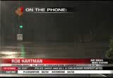
the napa river, at st. helena is expected to crest around noon. with two- feet over its flood stage. the flood stage is at 16 ft.. and if it goes towards map but it could reach its flood stage later this afternoon. >> the russian river? >> the russian river, near well above its flood stage. later this afternoon. as it works down towards guernville. just under 32 ft. and cresting overnight tonight and tomorrow. >> as you move the south and south-east in the santa cruz mountains they have also been concerned as well as rivers and streams. how is that? >> there have been good responses with 2-3 in. of rain fall of the higher elevations. officials are watching that area. the creeks are responding, everywhere. good advice and keeping people away from the water waste. not a good time to be out. be careful with driving through a flooded road race. it is a good way to get into trouble very fast. >> rob, if you're looking later what would you tell people that live along the napa ri in the nab russian river? >> the flow is going to continue to remain high i
the napa river, at st. helena is expected to crest around noon. with two- feet over its flood stage. the flood stage is at 16 ft.. and if it goes towards map but it could reach its flood stage later this afternoon. >> the russian river? >> the russian river, near well above its flood stage. later this afternoon. as it works down towards guernville. just under 32 ft. and cresting overnight tonight and tomorrow. >> as you move the south and south-east in the santa cruz mountains...
327
327
tv
eye 327
favorite 0
quote 0
novato, nine miles, napa, the fog migrating towards the east, napa, seven miles visibility. the rest of the bay area doing pretty good but the central valley fog will migrate back torts the west overnight. that could pose some travel problems tomorrow morning. right now we're 54 in antioch. 44 in concord. 52, san francisco. napa, 40. 48 in mountain view. we'll continue with the patchy areas of dense fog overnight. warmer getting into sunday and monday, and then start to cool things down and bring showers back into our forecast. lows tonight, generally mid-to upper 30s in the north bay, a little warmer thanks to the veil of clouds over you. 47 for san francisco tonight and we'll go 37 with pockets of fog near the livermore valley area. here's what i'm talking about. fog, very dense in the central valley, and then the winds migrate back towards the west so towards the delta, antioch, oakley, brentwood, you may wake up with very dense fog and then it should start to thin out by around, i'd say,here's the 11:0. here's the setup. high pressure diverting storms to the north of us.
novato, nine miles, napa, the fog migrating towards the east, napa, seven miles visibility. the rest of the bay area doing pretty good but the central valley fog will migrate back torts the west overnight. that could pose some travel problems tomorrow morning. right now we're 54 in antioch. 44 in concord. 52, san francisco. napa, 40. 48 in mountain view. we'll continue with the patchy areas of dense fog overnight. warmer getting into sunday and monday, and then start to cool things down and...
181
181
tv
eye 181
favorite 0
quote 0
novato, nine miles, napa, the fog migrating towards the east, napa, seven miles visibility. the rest of the bay area doing pretty good but the central valley fog will migrate back torts the west overnight. that could pose some travel problems tomorrow morning. right now we're 54 in antioch. 44 in concord. 52, san francisco. napa, 40. 48 in mountain view. we'll continue with the patchy areas of dense fog overnight. warmer getting into sunday and monday, and then start to cool things down and bring showers back into our forecast. lows tonight, generally mid-to upper 30s in the north bay, a little warmer thanks to the veil of clouds over you. 47 for san francisco tonight and we'll go 37 with pockets of fog near the livermore valley area. here's what i'm talking about. fog, very dense in the central valley, and then the winds migrate back towards the west so towards the delta, antioch, oakley, brentwood, you may wake up with very dense fog and then it should start to thin out by around, i'd say, 10:00, 11:00. here's the setup. high pressure diverting storms to the north of us. t
novato, nine miles, napa, the fog migrating towards the east, napa, seven miles visibility. the rest of the bay area doing pretty good but the central valley fog will migrate back torts the west overnight. that could pose some travel problems tomorrow morning. right now we're 54 in antioch. 44 in concord. 52, san francisco. napa, 40. 48 in mountain view. we'll continue with the patchy areas of dense fog overnight. warmer getting into sunday and monday, and then start to cool things down and...
123
123
Dec 4, 2012
12/12
by
KTVU
tv
eye 123
favorite 0
quote 0
napa, vacaville and fairfield. this will remain over the north bay through most of the afternoon. hit or miss showers, periods of rain, a few periods of dry weather. it will spread south and when it does, the steadier rain will begin to move our way. coming up, i will tell you when we can expect the evening drive, when we'll see the heaviest rain and when we'll be dry. >>> in san mateo county, road crew are the trying to shore up highway 1 before the rain tonight. they are trying to stop erosion from the weekend storm in pacifica. that will mean traffic delays in the area the highway was completely shut down overnight until the work began at 9:00 a.m. there are one-way controls in place right now. they hope to have everything back open by 3:00 this afternoon. >>> in a couple of hours, the san francisco board of supervisors will cast their final vote on the public nudity ban. brian flores joins us live from san francisco. there's still strong emotions on this. >> reporter: hi, tori. yes, still strong emotions. despite a large group of nudists at city hall -- >> shame on you! shame
napa, vacaville and fairfield. this will remain over the north bay through most of the afternoon. hit or miss showers, periods of rain, a few periods of dry weather. it will spread south and when it does, the steadier rain will begin to move our way. coming up, i will tell you when we can expect the evening drive, when we'll see the heaviest rain and when we'll be dry. >>> in san mateo county, road crew are the trying to shore up highway 1 before the rain tonight. they are trying to...
231
231
Dec 9, 2012
12/12
by
KTVU
tv
eye 231
favorite 0
quote 1
temperatures in the north bay. 36 in napa valley. and santa rosa. and 5 degrees what we felt 24 hours ago. a little bitter there. widespread 40s and livermore. 51 degrees. we are off to a better start this morning. we are soaring above yesterday's highs. 67 for santa rosa. and these numbers four to 8 degrees above the seasonal average. 65 expected in oakland. and low 60s in san francisco and out to candlestick to watch the 49ers play, it is a mild one. mid 60s for hayward and down to 66 in san jose. and 67 in morgan hill. how about santa cruz mostly sunny skies and 66 expected in your afternoon. the extended forecast here, we will hold onto the above normal temps through monday. and then we start to see the changes move our way. partly sunny skies. you will feel the transition by the second half of the afternoon. we wake up wednesday afternoon with scattered showers and look at the afternoon high. they take a plunge. expected 50s for the afternoons. i will show you the forecast model on the rain coming up. >>> tragic story out of pennsylvania after
temperatures in the north bay. 36 in napa valley. and santa rosa. and 5 degrees what we felt 24 hours ago. a little bitter there. widespread 40s and livermore. 51 degrees. we are off to a better start this morning. we are soaring above yesterday's highs. 67 for santa rosa. and these numbers four to 8 degrees above the seasonal average. 65 expected in oakland. and low 60s in san francisco and out to candlestick to watch the 49ers play, it is a mild one. mid 60s for hayward and down to 66 in san...
176
176
Dec 8, 2012
12/12
by
KRON
tv
eye 176
favorite 0
quote 0
napa as well as fairfield are affected by this dense fog. you can see where this is sitting in the north bay as well as the bay shore area. by 10:00 a.m. we are expected clear skies and it will stay this way for the rest of the after dole. afternos 37 degrees and napa and upper 30's for sunnyvale. that afternoon highs will warm-up to the '60s. it will be 60 degrees for your east bay shore and along the peninsula. 62 degrees is expected for downtown san francisco. there will be plenty of sunshine outside but it will get down to about low 20s. >> for the 7 day around the bay will be plenty of sunshine for the work week. on wednesday there may be showers. >> the rain has stopped, but the problems persist. this is especially for the santa cruz mountains. vine hill road is opened again now but only to one lane of traffic. the slide that washed out the road in scotts valley, is the latest on a long list the road repair projects and the list gets longer with each new storm. there is damage to a least 26 different roles. from the summit to the soque
napa as well as fairfield are affected by this dense fog. you can see where this is sitting in the north bay as well as the bay shore area. by 10:00 a.m. we are expected clear skies and it will stay this way for the rest of the after dole. afternos 37 degrees and napa and upper 30's for sunnyvale. that afternoon highs will warm-up to the '60s. it will be 60 degrees for your east bay shore and along the peninsula. 62 degrees is expected for downtown san francisco. there will be plenty of...
191
191
tv
eye 191
favorite 0
quote 0
spike in rivers up north nowhere near flood stage for the napa river. north same as you head towards st. helena, napa river will stay well below flood stage. >>> good news for muni commute there's morning who were stranded yesterday, everything back in full service, all power back, no delays for mei all mass transit on time, expect a nice ride on muni got our fingers crossed. highway 1 devils slide, one-way road control as you make your way from the coast towards pacifica or veers versa due to erosion from -- or vice versa due to erosion from the storms. light traffic into san francisco, no metering lights. >>> 5:26. growing debate in morning over remarks broadcaster bob costas made about gun control during halftime of nbc's sunday night football it has some calling for his firing. while discussing the weekend murder-suicide involving jovan belcher and his girl , costas said if belcher didn't possess a gun and he perkins would be alive today that triggered a backlash from gun rights advocates some calling for nbc's ouster. no comment from the network. >
spike in rivers up north nowhere near flood stage for the napa river. north same as you head towards st. helena, napa river will stay well below flood stage. >>> good news for muni commute there's morning who were stranded yesterday, everything back in full service, all power back, no delays for mei all mass transit on time, expect a nice ride on muni got our fingers crossed. highway 1 devils slide, one-way road control as you make your way from the coast towards pacifica or veers...
292
292
Dec 2, 2012
12/12
by
KRON
tv
eye 292
favorite 0
quote 0
on top of what we have already had with wrap rising of the rivers, the napa river, the russian river, we will keep a close eye with rapid rise in the guard claude storm drains. we will keep that close eye with storm warnings and flash flood warnings in effect. what should we expect? the heaviest will be in the morning, early. be prepared. the rain gear, right next to the door because it is one to be a wet sunday morning. wind-6 in. and windy. there is a high wind advisory by 10:00 p.m. flooding, mudslides, downed trees, downed power lines and please keep that in mind if you are traveling. futurecast, a tiny it out. we will be sitting over the north bay. timing it out flooding is a major concern is not until after midnight tonight that will slowly see that front move for the rest of the bay area. even by 5:00 p.m., that moderate rainfall is north of the golden gate. scattered showers for the rest of the bay area as we continue on going to be getting whatdy a sunday morning. santa rosa, all the way to the south by and all the way to the santa cruz mountains. the good news is that you wi
on top of what we have already had with wrap rising of the rivers, the napa river, the russian river, we will keep a close eye with rapid rise in the guard claude storm drains. we will keep that close eye with storm warnings and flash flood warnings in effect. what should we expect? the heaviest will be in the morning, early. be prepared. the rain gear, right next to the door because it is one to be a wet sunday morning. wind-6 in. and windy. there is a high wind advisory by 10:00 p.m....
270
270
Dec 8, 2012
12/12
by
KRON
tv
eye 270
favorite 0
quote 0
tomorrow, sunny skies and mild with the much of the same tomorrow. 34 in napa, santa rosa, 35 degrees in fairfield, livermore with the low 40's for the east bayshore. warming up into the 60s for the afternoon for most locations. 60s in livermore. and 60s in the san francisco a look at your extended forecast. warmer conditions sunday and early next week but a chance of showers returning. >> a young boy and a young woman after a collision with a sedan and a big rig area of eastern contra costa county. this happened on byron highway and clifton court road and byron is still closed... this is from abc's seven high- definition. as traffic was backing up the 21 year-old female driver lost control had crossed >>pam: the prank call surrounding the hospital where the duchess of cambridge was staying at has resulted in a death the nurse who originally took the call, jacintha saldanha, committed suicide. radio station, pretending to be queen elizabeth and prince charles, tricked her into putting them through to catherine's ward. a royal spokesman says the royal family are deeply saddened to lear
tomorrow, sunny skies and mild with the much of the same tomorrow. 34 in napa, santa rosa, 35 degrees in fairfield, livermore with the low 40's for the east bayshore. warming up into the 60s for the afternoon for most locations. 60s in livermore. and 60s in the san francisco a look at your extended forecast. warmer conditions sunday and early next week but a chance of showers returning. >> a young boy and a young woman after a collision with a sedan and a big rig area of eastern contra...
271
271
Dec 5, 2012
12/12
by
KTVU
tv
eye 271
favorite 0
quote 0
a little bit there on the richmond side, but north san rafael, napa county, things are really starting to calm down. vallejo you can see the line there. bill tweety, .30. crockett, about the same, more towards rodeo, a pocket of rain near richmond. to the east bay, things are moving south, concord, walnut creek, san ramon, blackhawk, you can see 580, livermore, pleasanton, dublin, fremont getting pretty good rain as well. to the peninsula, san mateo had really heavy rain. so did woodside. it looks like it is over stanford. right there and then back to san jose and also in the santa cruz mountains. sunnyvale had heavy rain for a while. cupertino. highway 17, things are picking um. boulder creek ben lomond, things are thicking up. are picking up. you can see there's some drying taking place and things like like they've ended on the north coast. for us us, this will be the last -- for us, this will be the last rainer of the pattern and then things will go dry. tomorrow morning, i will be talking about thick fog. >> really? >> it's really mild out there and there will be areas of fog. the
a little bit there on the richmond side, but north san rafael, napa county, things are really starting to calm down. vallejo you can see the line there. bill tweety, .30. crockett, about the same, more towards rodeo, a pocket of rain near richmond. to the east bay, things are moving south, concord, walnut creek, san ramon, blackhawk, you can see 580, livermore, pleasanton, dublin, fremont getting pretty good rain as well. to the peninsula, san mateo had really heavy rain. so did woodside. it...
203
203
Dec 10, 2012
12/12
by
KRON
tv
eye 203
favorite 0
quote 0
low '40's in napa and santa rosa. for these are your morning lows. temperatures will continue to drop as we enter into sunrise. later this morning everyone in the '50s as we set the clock into motion to be in your afternoon highs. climb to the '60s. seventies the possibility north of santa rosa. it is turning out to be a nice day around the bay area. your afternoon highs temperatures above average. 66 for oakland. 63 exit for cochrane fairfield. we do have changes high pressure in control for now. what will happen in area of low pressure will drop down from the gulf of alaska bringing cool air into the bay area. it will be a cold one by the middle of this week. we do expect rain 11:00 p.m. tuesday night. f mostly cloudy conditions not until the overnight hours where we start to see some showers. it will approach from the north bay first. we could see between a quarter and and half inch of rain here in the bay area. this is not a heavy system, in fact it will bring scattered showers. it will be dry thursday into friday. we have another storm system he
low '40's in napa and santa rosa. for these are your morning lows. temperatures will continue to drop as we enter into sunrise. later this morning everyone in the '50s as we set the clock into motion to be in your afternoon highs. climb to the '60s. seventies the possibility north of santa rosa. it is turning out to be a nice day around the bay area. your afternoon highs temperatures above average. 66 for oakland. 63 exit for cochrane fairfield. we do have changes high pressure in control for...
350
350
Dec 9, 2012
12/12
by
KRON
tv
eye 350
favorite 0
quote 0
temperatures 40's and napa, novado, '50s in san francisco. mid 40's for the east bayshore. a mixture of 50s and 60s indicated by the green. more widespread by noon. and as for the afternoon highs upper 60s. for those going out this evening a mixture of 50s and 60s. taking a look at those numbers. half moon bay, 60s and oakland. sunny for los gatos with mid-60s for the inland valleys. 69 degrees and the santa rosa. and even beautiful conditions expected for downtown san francisco. though snowfall expected for lake tahoe. we are showing some what weather in the forecast. >> on that note, thank you, john do. if the crowds and traffic... janu. >> if the crowds and traffic shopping. you're in luck. today, we have some gift ideas you can purchase online or at least look into ahead of time before venturing outside. joining us this morning is. mike wallenfels. he's the c- e-o of timbuk 2 in san francisco. >> for the adrenaline junkie dad - gopro hero3 silver edition: $299 it has better resolution, and easy to use and it is even a wireless capability. >> the size of this is amazing.
temperatures 40's and napa, novado, '50s in san francisco. mid 40's for the east bayshore. a mixture of 50s and 60s indicated by the green. more widespread by noon. and as for the afternoon highs upper 60s. for those going out this evening a mixture of 50s and 60s. taking a look at those numbers. half moon bay, 60s and oakland. sunny for los gatos with mid-60s for the inland valleys. 69 degrees and the santa rosa. and even beautiful conditions expected for downtown san francisco. though...
169
169
Dec 8, 2012
12/12
by
KTVU
tv
eye 169
favorite 0
quote 0
santa rosa 40 degrees right now. 41 at napa. in overnight hours around sunrise, we slipped into the low to mid-30s. so an improvement. 46 in oakland. but that said, it's still with a chill out there. 63 in oakland for the afternoon. 62 in fremont. fast forward to wednesday morning, we may wake up with scattered showers. passing by the afternoon, but roll into thursday because you can see you may be a little unsettled there. between now and then, some dry nice weather in store. tomorrow will be the warmer day, monday mostly sunny, mid up toker 60s in the forecast as well. and then we see a transition on tuesday. the wet weather holds off until wednesday. but the model is going to bring us scattered showers and unsettled through thursday. back to you. >>> more than 200 patients across the nation were given a early christmas gift day, the gift of mobility. 1 surgeons provided free joint replacements to those who don't qualify for government assistance and don't have health insurance. a team participated in the program giving one wo
santa rosa 40 degrees right now. 41 at napa. in overnight hours around sunrise, we slipped into the low to mid-30s. so an improvement. 46 in oakland. but that said, it's still with a chill out there. 63 in oakland for the afternoon. 62 in fremont. fast forward to wednesday morning, we may wake up with scattered showers. passing by the afternoon, but roll into thursday because you can see you may be a little unsettled there. between now and then, some dry nice weather in store. tomorrow will be...
118
118
Dec 6, 2012
12/12
by
KTVU
tv
eye 118
favorite 0
quote 0
tomorrow morning valley fog is going to be on your radar for sure. 47 santa rosa, 57 in napa. dew points tonight are going to be in the upper 40s, low 50s so when that dew point temperature is 50 degrees or 48 degrees in vallejo, when vallejo hits 48 degrees, poof, yao get fog. i think dew points are going to be in the 50s because it's so moist. showers remain about 10:00 tonight yao see lightly-scatter shouders, drizzle event and stuff out by the mission peak area and up by mount hamilton but that's about it. so when i come back we're going to chase the rain out of here with the rest of this model. running a pinpoint where the fog will be tomorrow morning, how it will impact your xhushths and then run out and look at theay area weekend because it's not that far away. see yao back here. >>> two people including a 15-year-old boy face the judge for the first time in a south bay crime rampage . >>> a beloved musician who popularized one of the most recognized jazz riffs in the world is gone. his bay area roots still ahead (car horn) paying with your smartphone instead of cash...
tomorrow morning valley fog is going to be on your radar for sure. 47 santa rosa, 57 in napa. dew points tonight are going to be in the upper 40s, low 50s so when that dew point temperature is 50 degrees or 48 degrees in vallejo, when vallejo hits 48 degrees, poof, yao get fog. i think dew points are going to be in the 50s because it's so moist. showers remain about 10:00 tonight yao see lightly-scatter shouders, drizzle event and stuff out by the mission peak area and up by mount hamilton but...
318
318
tv
eye 318
favorite 0
quote 0
a little fog by napa, as well, with 45 in oakland. 50 in san jose. you are warmer. look at the 57 half moon bay. 24 hours ago we were chillier. in fact if you are waking up in fremont and livermore, you will notice that the chill in the air and not quite as significant. a little warmer in redwood city, as well as san francisco. so starting out with a few clouds around and some fog in the north bay. otherwise warmer conditions today and tomorrow. we will be well into the 60s. in fact, some areas county could approach 70 degrees by tomorrow. things will turn around. we get a wind shift and it will be cooler, as much as ten degrees cooler and showers arrive overnight tuesday, into wednesday. today forecasting highs from the 60s in richmond, san francisco, and otherwise everyone else will be well into the mid-670s. for this time of the year we are up anywhere from three to eight degrees where we should be. so usually the upper 50s should do it. we do have a couple dry days to boot on top of that. the reason why is because of this, high pressure building into the eastern
a little fog by napa, as well, with 45 in oakland. 50 in san jose. you are warmer. look at the 57 half moon bay. 24 hours ago we were chillier. in fact if you are waking up in fremont and livermore, you will notice that the chill in the air and not quite as significant. a little warmer in redwood city, as well as san francisco. so starting out with a few clouds around and some fog in the north bay. otherwise warmer conditions today and tomorrow. we will be well into the 60s. in fact, some areas...
183
183
Dec 6, 2012
12/12
by
KRON
tv
eye 183
favorite 0
quote 0
temperatures in the 40's and the '50s. 44 in santa rosa, 45 degrees in napa. and upper 40's for our inland valleys and and and low 50s in the south bay. 60s for the south bay. and in los gatos, san jose, 60s in mountain view. low 60s for the inland valleys and also for the east bayshore with the exception of alameda. checking in at 59 degrees. upper 50s along the coast. 58 in san francisco, upper 50s for the north bay. as for the sierras, we did see snowfall from this last system but drier conditions expected. mostly sunny skies but let us take a look at your snwobobm fevski resort just last week the base was nearly 30 in. and now it is nearly 60 in.. kirkwood, 3 in. of new snow, north star @ lake tahoe, also knew snowfall go to snowbomb... for more. delays at sfo possible right now there are three our are riding flights and tomorrow more sunshine for the weekend. slightly warmer conditions expected. >> announcer: it is now time for sports and director, gary radnich. that's sonny dykes leading his louisiana tech bulldogs in their fight song earlier this year.
temperatures in the 40's and the '50s. 44 in santa rosa, 45 degrees in napa. and upper 40's for our inland valleys and and and low 50s in the south bay. 60s for the south bay. and in los gatos, san jose, 60s in mountain view. low 60s for the inland valleys and also for the east bayshore with the exception of alameda. checking in at 59 degrees. upper 50s along the coast. 58 in san francisco, upper 50s for the north bay. as for the sierras, we did see snowfall from this last system but drier...
 Live Music Archive
 Librivox Free Audio
 Metropolitan Museum
 Cleveland Museum of Art
 Internet Arcade
 Console Living Room
 Books to Borrow
 Open Library
 TV News
 Understanding 9/11